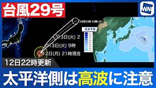
NAHA - Typhoon No. 24 is forecast to follow an unusual looping path near Okinawa and south of Japan before weakening into a tropical depression, while the warm, moist air it carries is intensifying the autumn rain front and bringing heavy rain to southern Kyushu, with the effects expected to spread across a wide area of Japan and persist into the beginning of next week. As of 9 p.m. on September 4, the typhoon was over waters west of Amami City and moving south at 20 kilometers per hour.
Its central atmospheric pressure was 994 hectopascals, with maximum sustained winds of 18 meters per second and maximum gusts of 25 meters per second.
The system is only at the lower threshold of typhoon strength and is not expected to develop significantly or form a storm-force wind zone.
The greater concern is therefore not the strength of the winds or the exact path of the center, but the large amount of warm, moist air being drawn northward by the storm and supplied to the stationary autumn rain front.
That moist air has already brought heavy rain to Miyazaki Prefecture since September 4.
In residential areas of Hyuga City, roads were flooded to depths of about 5 to 10 centimeters, with water continuing to rise as the rain persisted.
Elsewhere in Miyazaki Prefecture, roads were inundated and water was reported gushing from roadside drainage channels as the heavy rain caused disruption in a number of locations.
Rain is expected to remain frequent in Miyazaki through September 6, raising the possibility that accumulated rainfall will increase further. Residents are being urged to remain alert to changes in the intensity of the rain.
Satellite imagery showed the typhoon's main cloud area near its center, while a much broader band of active clouds stretched far to the east and appeared to merge with the autumn rain front.
The typhoon is forecast to continue moving south and reach waters south of Okinawa's main island by 9 p.m. on September 5.
It is then expected to turn eastward before curving north again between September 6 and September 7, reaching waters east of Minami-Daito Island by 9 p.m. on September 7.
By 9 p.m. on September 8, the system is forecast to be south of Japan and weakening as it moves north, with forecasters expecting it to become a tropical depression.
The storm's complicated movement is expected to keep feeding water vapor toward Japan even after the typhoon itself begins to weaken, potentially prolonging its impact over a wide area of the country.
Forecast simulations show a sharp difference in humidity along the autumn rain front, with particularly moist air on its southern side being transported from the tropical system toward western and then eastern Japan.
During the 24 hours from 9 p.m. on September 4 to 9 p.m. on September 5, rainfall could reach around 300 millimeters in parts of southern Kyushu and the Tanegashima and Yakushima areas.
From 9 p.m. on September 5 to 9 p.m. on September 6, parts of Miyazaki Prefecture could receive 200 to 300 millimeters of rain, while some areas of the Kii Peninsula may see 150 to 200 millimeters.
The heavy rain threat is then expected to shift eastward.
From the night of September 6 through September 7, substantial rainfall is forecast across the Tokai and Kanto regions and into southern Tohoku.
Parts of the Kanto region could receive more than 300 millimeters of rain, raising the risk of flooding, landslides and other weather-related disasters at the start of next week.
Forecasters are urging residents to closely monitor the latest information, as the interaction between Typhoon No. 24 and the autumn rain front could produce dangerous rainfall well away from the center of the storm and keep affecting much of Japan for several days.
Source: ウェザーニュース