OSAKA - A newly formed tropical depression in the South China Sea could bring another round of heavy rain to western Japan as it interacts with the seasonal rain front, meteorologists have warned, only days after Typhoon Jangmi (Typhoon No. 6) caused widespread damage across the country.
Speaking on Kansai TV's "Shunkan LIVE Toretate!", weather forecaster Atsushi Katahira explained that while the new system is not currently expected to develop into a typhoon, it could still significantly increase rainfall by supplying large amounts of warm, moisture-laden tropical air to the Baiu seasonal rain front.
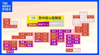
The warning comes after Typhoon Jangmi triggered severe flooding and strong winds across much of Japan. In Tokyo, several rivers reached Level 4 flood danger status under the country's newly introduced disaster warning system.
Katahira emphasized the importance of understanding the new alert levels, noting that Level 4 indicates a disaster is imminent and residents should already have evacuated from dangerous areas. Level 5, by contrast, means a disaster is already occurring.
"In Wakayama, a Level 5 warning was issued after the Kozagawa River overflowed," Katahira said. "People living near rivers or unstable slopes should leave dangerous areas while conditions remain at Level 4."
He cautioned residents not to rely solely on visible warning signs such as small landslides, falling rocks, unusual water seepage, or sudden changes in water flow, as disasters can occur without obvious precursors. However, if such signs are observed, the danger may already be critical.
The forecaster also highlighted the risks posed by strong winds, noting that flying objects can become hazardous projectiles. He urged residents to secure items on balconies and around homes before storms arrive.
Attention is now focused on a tropical depression that formed west of the Philippines in the South China Sea. According to forecast models, the system is expected to move toward Taiwan before approaching the East China Sea.
Although it is unlikely to strengthen into a typhoon, its interaction with the Baiu front is causing concern.
"This tropical depression is essentially a mass of warm, humid tropical air," Katahira explained. "As it approaches the front, it can enhance rainfall and make the rain front much more active."
The concern is heightened because many areas have already received significant rainfall from recent weather systems. Saturated ground conditions mean that even moderate additional rain could increase the risk of flooding and landslides.
Rain clouds associated with the Baiu front were already spreading across Kyushu and Shikoku on June 4th, with rain expected to reach the Kansai region earlier than previously forecast. The rain area has also expanded farther north than earlier projections suggested.
Japan's Meteorological Agency declared the start of the rainy season in the Kinki region, the Chugoku region, and northern Kyushu on June 4th.
Forecast models indicate that rainfall will continue affecting western Japan through June 5th, while eastern areas including the Kanto region are expected to remain largely outside the main rain band for now. However, the situation could change as the tropical depression approaches.
By June 7th and June 8th, the depression and the seasonal front are expected to move northward together, potentially bringing another period of heavy rain from western Japan eastward.
Meteorologists are urging residents to closely monitor weather updates and remain alert for flooding and landslide risks from Sunday through Monday as the next weather system develops.
Source: KTV NEWS