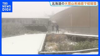
HOKKAIDO - Hokkaido is expected to remain rainy under the influence of a low-pressure system and the seasonal rain front, with locally intense downpours possible during the morning and flooding risks in low-lying areas.
Active rain clouds extended from around the Tsugaru Strait into southern Hokkaido, bringing heavy rain to parts of the region as well as the Tsugaru Peninsula in Aomori Prefecture.
A low-pressure system over the Sea of Japan was drawing warm, moist air toward an accompanying front, causing rain clouds to develop across northern Japan. The low-pressure system is forecast to remain near northern Hokkaido through the evening, while the front stretches around the Tsugaru Strait.
Rain clouds are expected to move eastward, bringing rainfall of up to 30 millimeters per hour to parts of the Hidaka and Tokachi regions during the morning.
Rain will continue across a wide area in the afternoon, although gaps in the rain clouds are expected to increase toward the evening and nighttime. Rain is likely to persist mainly along the Pacific side, near the front, and in northern Hokkaido, closer to the low-pressure system.
More than 100 millimeters of additional rainfall is forecast in the Hidaka region during the 24-hour period, with totals of around 100 millimeters also possible from parts of the Tokachi region to the Kushiro area.
Residents are being urged to remain alert for flooded roads, inundation of low-lying land, landslides caused by loosened ground and rising river levels. Particularly heavy rainfall is possible along Hokkaido's Pacific coast.
Cloudy conditions are also expected across the Tohoku region, with rain likely in many areas, particularly in the north.
Source: ウェザーニュース